Posts

Showing posts from September, 2018

The Loop Head loop.

Image
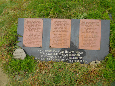
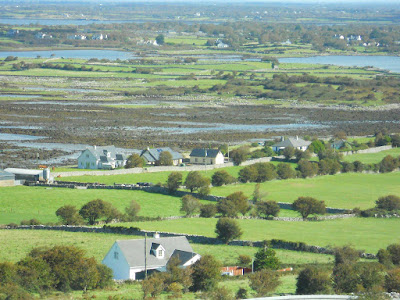
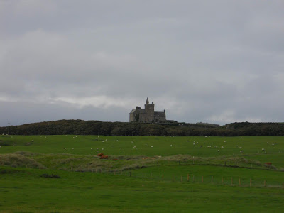
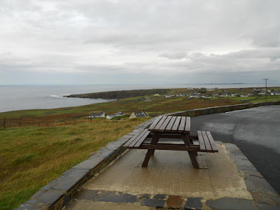
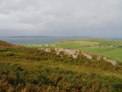
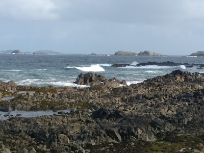
After the sunshine of Monday, Tuesday was cloudy and very windy but rain free. Our plan was to investigate the Loop Head peninsula, an area less known to the tourists but still on the Wild Atlantic Way. Kilkee was the starting point, and to the south were the Cliffs of Kilkee. These are not as well known as the Cliffs of Moher, but are much more accessible - and wilder. There was absolutely no concession to health and safety - you could walk right up to the sheer cliff edges. As the strong wind was behind me I stood a prudent distance back! This young lad didn't. You can see the height of the cliffs, and at one place there were fishermen casting out. The photo doesn't really show the drop, but it was there alright. Further down the peninsula were the Bridges of Ross. There were originally three, and were very popular in Victorian times. Only one now remains. It was here that the storm scenes in Ryan's Daughter were filmed. However, all th

We saw the sun go down o'er Galway Bay

Image
Sunday's journey was a drive around Galway Bay, from the usual beautiful coast views of the north to the bleak but dramatic Burren on the south. Just to be different, this is just below Galway town with the tide out. The Burren is a huge area of white rock mountains and, down by Black Head, strange lava flow remains. The weirdly flat table is strewn with fissures and cracks, and reminded me of the Giants Causeway turned on its side. That night we stopped at a pleasant site in the village of Doolin, and had the first real sunset of the holiday. Monday morning we headed off south just a little way to the Cliffs of Moher, and played a merry game of dodge the tour buses - by 10 am they started to arrive in droves. The cliffs are apparently Ireland's most visited tourist attraction, and they have gone to town on it with excellent viewing platforms, a visitor centre discretely built into the rocks, and all the Irish souvenirs you could wish for. The ca

The desolation of Doo

Image
We had a longer journey than normal planned for Saturday, not just because we stayed an extra day in Achill Island, but also because we needed to refill our LPG cylinder and the nearest Autogas fuel station was in Castlebar. This meant an extra 40 miles. The garage had a small supermarket attached, but it was very modern, was excellently stocked and even had a large deli selling freshly cooked roast dinners. There are garages like this all over Ireland, and are replacing the traditional corner shop. Even small villages have one, and they play a great part in keeping communities together. It was then back down the N5 to Westport, and rejoin the Wild Atlantic Way which headed out along the south coast of Clew Bay. Along the way was the beginning of the walk up to the summit of Croagh Patrick - Ireland's answer to Mecca. On the last Sunday in July there is a mass pilgrimage to the top, the more devout climbing it barefoot. At Louisburgh the road turns south into some really deso

What a difference a day makes!

Image
Storm Bronagh hit last night in the wee hours (and as you get older the phrase is more and more accurate). However it had none of the viciousness of Ali and by 10am there was sunshine! Mind you, it was very breezy, and quite a bit colder than of late. Time to tour Achill Island, and the beauty of a motorhome meant that the time between decision to go and actually leaving was only a few minutes. Achill isn't very big, but if you are not on main roads progress is leisurely. First port of call was just over the headland from Silver Strand (our beach) to Golden Strand (rival campground beach).Ours was better!  Incidentally, there was a Presbyterian mission here aeons ago to convert the heathen catholics, which accounts for the large number of Ulster names here.  On the north east corner is Bull's Mouth, and a stretch of water across to the island of Innisbiggle. This apparently has the strongest tidal current in Europe. I didn't test it out. A little bit of tittle tattle -

Bunkered down in Ballina

Image
Well, that has been a blowy few days! First the tail end of Helene, and then Ali following in hard behind her. The in between storms journey from Lough Glencar to Ballina meandered as usual along the Atlantic coast, but actually wasn't all that interesting. All of the mountains were covered in cloud and mist, so I didn't take any photos. In any case, we wanted to get to Ballina and find a sheltered pitch. The campsite is called Belleek Park, and has nothing to do with the town of Belleek. However, I think it was a great place to wait out Ali, which arrived furiously at four on Wednesday morning, and lasted through until midday.  Discretion dictated that we would stay another night in Ballina, so in the afternoon I walked into the town for a haircut. It was about forty minutes walk each way,  but inevitably I got caught in a shower or two. It is a fine little town, though. This is the gatehouse to Belleek Castle, some two miles from the Castle, and was lived in until a few

Have you ever seen a waterfall go uphill?

Image
Last night at the Termon Complex  in Pettigo was very quiet indeed - we were the only people there, but had a quiet night. Apparently the boy racers tried to use the car park once, but were told in no uncertain terms that their cars would be confiscated and crushed. That's the way the Garda do it. The facilities on site were excellent. We headed north west out of Pettigo towards Donegal,  and picked up the Wild Atlantic Way south again through Ballyshannon and Bundoran. I wasn't too impressed with either - Ballyshannon was very artificial, and Bundoran reminded us of Portrush, seedy and full of amusement parlours. Much more interesting was Mullaghmore, beside Classiebawn Castle and Classiebawn harbour. This was the home of Lord Louis Mountbatten, who was blown up in his boat there. We had decided last night that staying on the coast with Storm Helene due was not a good idea, so headed inland to Lough Glencar, north east of Sligo. It's quite dramatic here, with

A trip around the lakes, and wondering what to do when Storm Helene arrives.

Image
Saturday morning was fairly bleak when we left Creeslough. The plan was to carry on the Wild Atlantic Way around the Donegal coast as far as Glenties, and then cut across via Ballybofey to Douglas Bridge (back in NI) to spend the night on Stewart and Georgie's farm. In between showers we caught glimpses of the dramatic coastline, such as this, called Bloody Foreland. The area is extensively farmed for peat, and some of the houses already had their fires going. The aroma is unmistakable. Despite health problems Stewart and Georgie are doing well, and were very accommodating - even taking us out for a meal. Whilst there, I was asked by my mother to visit and photograph a plaque commemorating my father. She had placed it by a small tree down by the River Mourne (part of the farm), and it really is the most delightfully peaceful place you could wish for. Sunday morning, and it's time to move on. We took the main roads to Enniskillin, and had a drive around Lough E

The beauty of not making too many plans.

Ann and I were looking at the map last night (rather than an app or Google Maps) and realised that were are not going to do everything we envisioned in the three weeks available to us. We have been here for six days, and are still in Donegal! Back in Wales, Ireland looked quite small on the map. However the Romans never made it here so the roads are.....crinkly, and because of the lack of width, quite slow. You can drive faster, but the locals don't for a very good reason! We met a school bus down a very narrow road yesterday, but by pulling in my mirror we could just get past. However the lady bus driver suddenly realised my overcab was going to take out her mirror. She uttered the words I have heard before in Ireland "Jesus, Mary, Joseph and the wee donkey!". So did I. We got past eventually, though. As this is not a picture blog, I'll go back to our first stop at Carlingford Marina. We got there later than expected due to ferry delays, but found a space and par

The Treaty Forts

Image
After a few days wild camping Ann and I were beginning to need a little TLC, so we rang ahead to book into the Wild Atlantic Campsite, and make use of their electric hookups, fresh water, laundry and waste disposal. More later on the site. Once again we were blessed with incredible views, especially over the Mamore Gap - another very steep first gear road. Once over the gap we called in at Fort Dunree. It is one of a series of forts built on both sides of Lough Swilley, and was used to protect Lord Jellicoe's fleet which was moved here from Scapa Flow during WW1. In fact, it stayed in British hands until 1938, and even after that during WW2 had a little known British presence. As with the War Years Remembered museum, the Irish are now beginning to accept and appreciate the contribution the whole of Ireland made to these wars, and that the two histories are far more intertwined than dogma had previously allowed. It is noticeable how much the peace process i

Malin to Creeslough.

Image
The way down from Malin Head to the town of Malin  was again spectacular. we called in at Doagh Famine Village (pronounced "dough" or "doh"). This is a strange place - an attempt by a local family to describe the social history of Ireland in tableau form. It works, but in a rather amateurish way. However the guide must have kissed the Blarney Stone, and was good entertainment. One of these cottages was actually lived in by the guide until the 1960's and had been preserved in that state with settle beds in the kitchen etc. The other cottages attempted to describe poteen making, wakes, evictions, land division, and how the whole social structure disintegrated when the potato blight started. Included in the entry price was a wee glass of poteen, which actually was quite pleasant! Back in Malin we overnighted in the car park behind McClean's all-in-one bar, shop and petrol station. Naturally enough we had to have a few drinks there, but weren'